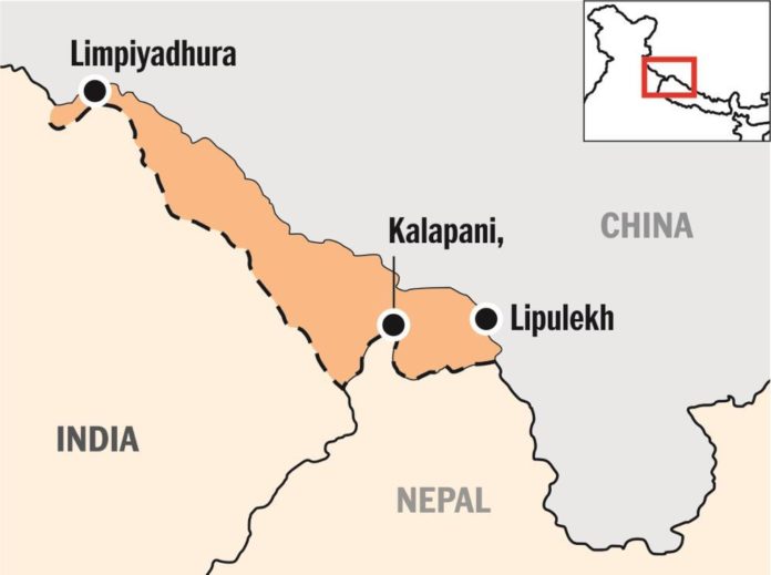
Kathmandu, June 18: Nepal’s National Assembly on Thursday unanimously passed the Constitution Amendment Bill to update the country’s political and administrative map incorporating the Indian territories.
India has termed as untenable the “artificial enlargement” of territorial claims by Nepal after its lower house of parliament on Saturday unanimously approved the new political map of the country featuring areas which India maintains belong to it.
The National Assembly, or the upper house of the Nepalese parliament, unanimously passed the constitution amendment bill providing for inclusion of the country’s new political map in its national emblem.
The bill was passed with all the 57 members present voting in its favour.
The ties between the two countries came under strain after Defence Minister Rajnath Singh inaugurated an 80-km-long strategically crucial road connecting the Lipulekh pass with Dharchula in Uttarakhand on May 8.
Nepal protested the inauguration of the road claiming that it passed through its territory. Days later, Nepal came out with the new map showing Lipulekh, Kalapani and Limpiyadhura as its territories.


